


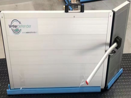
Fabricated aluminum alloy flood wall system
Home > product > Fabricated aluminum alloy flood wall system
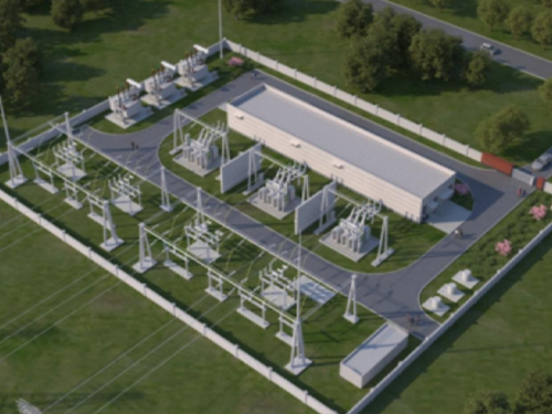
SUBSTATION FLOOD CONTROL EARLY WARNING SYSTEM
Column:Fabricated aluminum alloy flood wall system
Describe:1. Real-time monitoring and data displayWater level monitoring: real-time display of substation reservoir, cable tr…
Product Details | PRODUCT DETAILS
1. Real-time monitoring and data display
Water level monitoring: real-time display of substation reservoir, cable trench,groundwater level and other data, and comparison with the warning water level; rainfallmonitoring: display real-time rainfall in substation area, and provide rainfall trendanalysis. Equipment status monitoring: monitoring the operation status of key equipmentin the substation, and finding the abnormality caused by flood in time; video monitoring:integrating the real-time video images inside and outside the substation, and visuallychecking the operation status of the equipment and the surrounding environment.
2. Flood prevention and early warning system
Flood early warning: according to data such as water level and rainfall, combined withhydrological model, flood risk is predicted and early warning is issued. Waterloggingearly warning: monitor the internal drainage system of substation, predict waterloggingrisk and prevent equipment from entering water. Geological disaster early warning:combining with geological conditions and rainfall data, predict the threats of landslidesand mudslides to substations
3. Substation flood controlresource managementFlood control materials management: show the inventory and distribution of flood controlmaterials (such as sandbags, water pumps, emergency generators, etc.) in thesubstation. Emergency team management: grasp the position and status of emergencyteam in substation in real time, support rapid dispatch, and equipment protectionmeasures: show the implementation of waterproof and moisture-proof measures for keyequipment in substation.
4. Data analysis and prediction
Historical data analysis: compare historical flood data, and analyze the severity andpossible development trend of current flood. Hydrological model prediction: based on thehydrological model, predict the future changes of water level and flow, and help toformulate countermeasures in advance. Risk assessment: Evaluate the risk level ofsubstation and surrounding areas by combining multi-dimensional data such asgeography, meteorology and hydrology.
5. Visual display
GIS map display: Display the flood distribution of substation and surrounding areathrough GIS map, and mark the dangerous points and the location of flood controlmaterials.
Visualization of equipment status: display the running status of equipment in substationand the implementation of flood control measures by means of charts and coloridentification.
Trend analysis: Show the changing trend of water level, rainfall and other data in theform of line chart and histogram.


Products
TEL
0510-83880031


 Home
Home
 Product
 Case
Case
 Contact